|
Getting your Trinity Audio player ready...
|
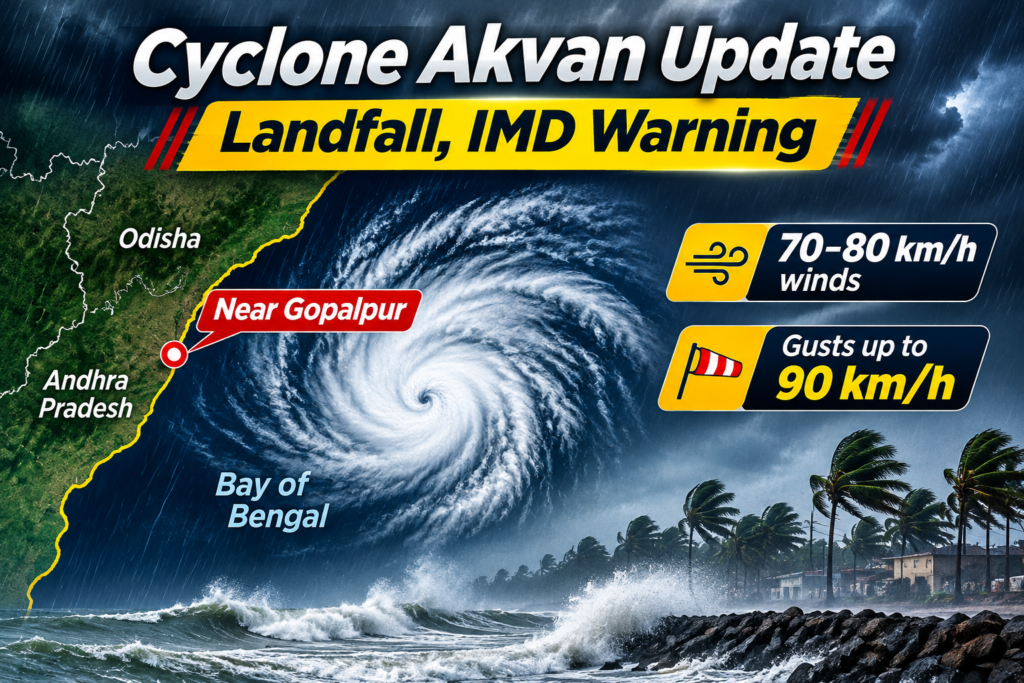
Cyclone Akvan has weakened from a severe cyclonic storm into a cyclonic storm over the west-central Bay of Bengal as it approaches the North Andhra Pradesh and South Odisha coastline. According to the India Meteorological Department (IMD), the system is expected to cross the coast near Gopalpur during the forenoon of November 20, 2026, with maximum sustained wind speeds of 70–80 kmph and gusts reaching 90 kmph.
The cyclone has triggered weather warnings across coastal Andhra Pradesh and Odisha, with authorities preparing for heavy rainfall, strong winds, rough sea conditions and possible disruptions to road and rail transportation. The latest developments indicate that the system has weakened compared with earlier forecasts, but coastal districts remain under close monitoring.
As Cyclone Akvan approaches land, residents in vulnerable coastal locations have been advised to follow official weather warnings and avoid unnecessary movement in areas affected by strong winds and heavy rainfall.
Cyclone Akvan Latest Update: What Is Happening on November 20?
The latest IMD National Bulletin issued at 2:30 AM IST on November 20 reported that Cyclone Akvan had weakened into a cyclonic storm over the west-central Bay of Bengal. The system was moving north-northwestwards at approximately 21 kmph.
At the time of the bulletin, the cyclone was located around 110 km southeast of Kalingapatnam in Andhra Pradesh, 170 km east of Visakhapatnam and 170 km south of Gopalpur in Odisha.
The IMD also reported that the land interaction process had begun as the storm’s associated cloud mass entered the North Andhra Pradesh–South Odisha coastal region.
The latest forecast indicated that Cyclone Akvan would continue moving north-northwestwards and cross the coast close to Gopalpur during the forenoon of November 20. Its maximum sustained wind speed was estimated at 70–80 kmph, with gusts reaching 90 kmph.
This represents a reduction from earlier forecasts, which had warned that the system could intensify into a very severe cyclonic storm with wind speeds reaching 120–130 kmph and gusts up to 145 kmph.
The weakening of the cyclone has reduced the forecast wind intensity, but heavy rainfall, localised flooding and coastal weather disruptions remain important concerns.
Cyclone Akvan Landfall: Where and When Will It Hit?
Cyclone Akvan is expected to cross the North Andhra Pradesh and South Odisha coastline close to Gopalpur on November 20, 2026.
The landfall forecast has changed during the development of the system. Earlier weather predictions indicated a possible crossing between Nellore and Visakhapatnam in Andhra Pradesh. However, subsequent IMD updates shifted the expected landfall zone towards the North Andhra Pradesh and South Odisha coastline, between Narsapur and Puri, close to Gopalpur.
The change in the projected path highlights why cyclone forecasts need to be monitored regularly rather than relying on initial predictions.
The coastal areas around Gopalpur, Kalingapatnam, Srikakulam and neighbouring districts are among the locations requiring close attention because of the storm’s movement.
Landfall is the stage when the centre of a tropical cyclone crosses the coastline from the sea onto land. During this period, coastal communities can experience strong winds, intense rainfall, rough sea conditions and temporary disruption to essential services.
As the cyclone moves inland, its wind intensity is expected to decrease further. However, rainfall may continue in several districts even after the main system weakens.
Cyclone Akvan Wind Speed: How Strong Is the Storm?
One of the major changes in the latest Cyclone Akvan update is the reduction in its wind intensity.
Earlier forecasts suggested that the system could become a very severe cyclonic storm before reaching the Indian coastline. However, the November 20 IMD bulletin classified it as a cyclonic storm, with lower expected wind speeds.
The latest forecast details are:
| Weather parameter | Latest IMD forecast |
|---|---|
| Cyclone name | Akvan |
| Current category | Cyclonic Storm |
| Wind speed | 70–80 kmph |
| Maximum wind gusts | Up to 90 kmph |
| Movement | North-northwestwards |
| Expected landfall | November 20, 2026 |
| Expected landfall area | Near Gopalpur |
| Affected coastal regions | Andhra Pradesh and Odisha |
The IMD forecast also indicated that the system would weaken further after crossing the coastline. By the evening of November 20, it was expected to weaken into a deep depression, followed by further weakening into a well-marked low-pressure area on November 21.
This weakening trend is important because cyclones generally lose strength after moving over land, as they lose access to the warm ocean water that supplies energy to the system. However, the risk of heavy rainfall and local flooding can continue even after wind speeds decrease.
Cyclone Akvan IMD Warning: Which States Are on Alert?
The India Meteorological Department issued weather warnings for several regions as Cyclone Akvan moved towards the eastern coastline.
Andhra Pradesh and Odisha are the primary states facing the impact of the system. Other nearby regions may also experience rainfall and unsettled weather depending on the cyclone’s movement.
1. Andhra Pradesh
Coastal Andhra Pradesh is among the most closely monitored regions. The cyclone’s movement towards the northern coastal districts has raised concerns about heavy rainfall, gusty winds and temporary disruptions.
The IMD had warned of extremely heavy rainfall in isolated areas of Coastal Andhra Pradesh and Yanam on November 19, followed by further rainfall activity on November 20.
Northern coastal districts, including Srikakulam, Vizianagaram and Visakhapatnam, require particular attention because of their proximity to the projected landfall region.
2. Odisha
Southern Odisha is another major region under the cyclone’s influence. Areas around Gopalpur, Ganjam and neighbouring coastal districts may experience strong winds and heavy rainfall.
The IMD forecast isolated extremely heavy rainfall over Odisha on November 19 and 20. Residents in low-lying areas and locations vulnerable to waterlogging should remain cautious.
3. Telangana
Parts of eastern Telangana may experience rainfall associated with the cyclone’s circulation. The impact is expected to be less direct than in coastal Andhra Pradesh and Odisha, but local weather conditions may remain unsettled.
4. Tamil Nadu
Tamil Nadu is not in the main projected landfall zone. However, the broader weather system may influence rainfall conditions in parts of the state. The IMD also forecast rainfall activity over Tamil Nadu, Puducherry and Karaikal during November 23–25.
These regional forecasts are based on the IMD’s November 20 bulletin and should not be interpreted as confirmation that every district will experience the same weather conditions.
Cyclone Akvan Rainfall Alert: Heavy Rain and Flooding Concerns
Heavy rainfall is one of the major weather risks associated with Cyclone Akvan.
Even after a cyclone weakens, its circulation can carry moisture inland and produce significant rainfall across affected regions. This can increase the possibility of waterlogging, flooding in low-lying locations, overflowing drainage systems and temporary disruption to road transportation.
Coastal Andhra Pradesh and southern Odisha are expected to experience the strongest rainfall impact.
The November 19 IMD press release had warned of isolated extremely heavy rainfall over Coastal Andhra Pradesh and Yanam on November 19, while Odisha was also expected to experience extremely heavy rainfall on November 19 and 20.
People living near rivers, streams, low-lying settlements and coastal areas should pay attention to local administration advisories. Even locations outside the immediate landfall zone can experience weather-related disruption.
Cyclone Akvan: Impact on Trains, Roads and Transportation
Cyclone Akvan has also raised concerns about transportation across eastern India.
Railway services can be affected during cyclonic weather because strong winds, heavy rainfall, waterlogging and safety restrictions may make train operations difficult.
According to reports published on November 20, the East Coast Railway cancelled 41 trains, including Vande Bharat services, while several other services were affected through cancellations or rescheduling.
These precautionary measures can affect passengers travelling through Odisha and Andhra Pradesh, particularly on routes connecting coastal cities.
Road transportation may also face difficulties in areas experiencing heavy rainfall, fallen trees, damaged electrical infrastructure and waterlogging.
Passengers planning to travel through the affected regions should verify their train status before leaving for the station. They should also follow local traffic advisories and avoid travelling through flooded roads.
Cyclone Akvan: Government Preparedness and Safety Measures
State authorities have taken precautionary measures to reduce the potential impact of Cyclone Akvan, particularly in vulnerable coastal districts.
Odisha has undertaken large-scale evacuation and relief preparations. Reports on November 20 indicated that nearly 3 lakh people had been evacuated and shifted to temporary relief camps. Rescue teams and cyclone shelters have also been mobilised to support people in vulnerable locations.
Emergency response preparations are important during cyclones because even a weakening storm can create dangerous conditions through rainfall, strong winds and coastal flooding.
Residents in affected areas should follow these precautions:
- Avoid visiting beaches, coastal areas and other exposed locations during the cyclone.
- Stay inside safe buildings during periods of strong winds.
- Keep drinking water, essential medicines, food and emergency supplies ready.
- Avoid touching fallen electric wires or damaged electrical equipment.
- Do not attempt to cross flooded roads or overflowing streams.
- Follow evacuation instructions issued by local authorities.
- Keep mobile phones charged and maintain contact with family members.
People should rely on official weather updates and government announcements rather than unverified social media messages.
Why Is Cyclone Akvan Weakening Before Landfall?
Cyclones develop over warm ocean waters and gain energy from moisture and heat supplied by the sea. When atmospheric conditions become less favourable or the storm interacts with other weather systems, its intensity can decrease.
Cyclone Akvan initially showed signs of strengthening over the Bay of Bengal. Earlier forecasts suggested that it could reach very severe cyclonic storm intensity before making landfall.
However, the latest IMD bulletin on November 20 confirmed that the system had weakened into a cyclonic storm.
The reduction in wind speed is a positive development compared with the earlier forecast. Nevertheless, weakening does not mean that the cyclone has become harmless. Heavy rainfall, strong gusts, rough sea conditions and localised flooding can still create serious problems.
The actual impact will depend on the cyclone’s final movement, rainfall distribution and local geographical conditions.
Cyclone Akvan Latest Forecast: What to Expect Next?
According to the IMD’s November 20 morning bulletin, Cyclone Akvan is expected to weaken progressively after crossing the coast.
The forecast suggests the following development:
| Date and time (IST) | Expected system |
|---|---|
| November 20, 2:30 AM | Cyclonic Storm |
| November 20, 5:30 AM | Cyclonic Storm |
| November 20, 11:30 AM | Cyclonic Storm |
| November 20, 5:30 PM | Deep Depression |
| November 21, 5:30 AM | Well-Marked Low Pressure Area |
These are forecast stages, not confirmation of the system’s actual position at each time. The IMD continues to monitor the storm through satellite observations and Doppler weather radars.
The coming hours are particularly important for coastal districts in Andhra Pradesh and Odisha as the system completes its land interaction and moves inland.
FAQs
1. What is Cyclone Akvan?
Cyclone Akvan is a tropical cyclone that developed over the Bay of Bengal in November 2026. It moved towards the eastern Indian coastline, affecting weather conditions across coastal Andhra Pradesh and Odisha.
2. When will Cyclone Akvan make landfall?
The IMD’s November 20 morning forecast indicated that Cyclone Akvan would cross the North Andhra Pradesh and South Odisha coastline close to Gopalpur during the forenoon of November 20, 2026.
3. Where is Cyclone Akvan expected to make landfall?
The forecast landfall area is near Gopalpur, along the North Andhra Pradesh and South Odisha coastline. The IMD identified the broader crossing zone between Narsapur and Puri.
4. What is the maximum wind speed of Cyclone Akvan?
The latest November 20 IMD forecast estimated maximum sustained winds of 70–80 kmph, with gusts reaching 90 kmph. Earlier forecasts had projected significantly stronger winds.
5. Which states are affected by Cyclone Akvan?
Andhra Pradesh and Odisha are the primary states affected by Cyclone Akvan. Parts of Telangana and other nearby regions may also experience associated rainfall.
6. Has Cyclone Akvan weakened?
Yes. According to the IMD’s November 20 bulletin, Cyclone Akvan weakened from a severe cyclonic storm into a cyclonic storm before reaching the coastline.
7. Is Cyclone Akvan dangerous after weakening?
Yes. Even a weakened cyclone can cause heavy rainfall, strong winds, waterlogging, local flooding and transportation disruptions. Residents should continue following official weather advisories.
8. Will Cyclone Akvan affect train services?
Yes. Reports on November 20 indicated that several railway services were cancelled or rescheduled as a precautionary measure. Passengers should check their individual train status before travelling.